
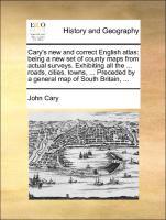
Cary's New and Correct English Atlas: Being a New Set of County Maps from Actual Surveys. Exhibiting All the ... Roads, Cities, Towns, ... Preceded by a General Map of South Britain, ... - pocketboek
2010, ISBN: 9781170963746
Gale Ecco, Print Editions, Taschenbuch, 154 Seiten, Publiziert: 2010-06-10T00:00:01Z, Produktgruppe: Buch, 0.63 kg, Moderne & Postmoderne, Epochen, Politik & Geschichte, Kategorien, Büche… Meer...
| amazon.de ErgodeBooks Ships From USA Gut Verzendingskosten:Gewöhnlich versandfertig in 7 bis 8 Tagen. Die angegebenen Versandkosten können von den tatsächlichen Kosten abweichen. (EUR 3.00) Details... |

Cary s new and correct English atlas: being a new set of county maps from actual surveys. Exhibiting all the . roads, cities, towns, . Preceded by a general map of South Britain, . - pocketboek
2010, ISBN: 1170963749
[EAN: 9781170963746], Neubuch, [PU: Gale ECCO, Print Editions], HISTORY MODERN 18TH CENTURY, KlappentextThe 18th century was a wealth of knowledge, exploration and rapidly growing technol… Meer...
| AbeBooks.de moluna, Greven, Germany [73551232] [Rating: 4 (von 5)] NEW BOOK. Verzendingskosten:Versandkostenfrei. (EUR 0.00) Details... |

Cary's New and Correct English Atlas Being a New Set of County Maps From Actual Surveys Exhibiting All the Roads, Cities, Towns, Preceded By a General Map of South Britain, - pocketboek
2006, ISBN: 9781170963746
Softcover, PLEASE NOTE, WE DO NOT SHIP TO DENMARK. New Book. Shipped from UK in 4 to 14 days. Established seller since 2000. Please note we cannot offer an expedited shipping service from… Meer...
| alibris.co.uk |

Cary's New and Correct English Atlas: Being a New Set of County Maps from Actual Surveys. Exhibiting All the . Roads, Cities, Towns, . Preceded by a General Map of South Britain, . - pocketboek
2010, ISBN: 1170963749
[EAN: 9781170963746], New book, [SC: 0.0], [PU: Gale Ecco, Print Editions], This item is printed on demand. New copy - Usually dispatched within 5-9 working days, Books
| AbeBooks.co.uk THE SAINT BOOKSTORE, Southport, United Kingdom [51194787] [Rating: 5 (of 5)] NEW BOOK. Verzendingskosten:Free shipping. (EUR 0.00) Details... |
Cary's New and Correct English Atlas: Being a New Set of County Maps from Actual Surveys. Exhibiting All the ... Roads, Cities, Towns, ... Preceded by a General Map of South Britain, ... - pocketboek
ISBN: 9781170963746
Paperback / softback. New., 6
| Biblio.co.uk |


Cary's New and Correct English Atlas: Being a New Set of County Maps from Actual Surveys. Exhibiting All the ... Roads, Cities, Towns, ... Preceded by a General Map of South Britain, ... - pocketboek
2010, ISBN: 9781170963746
Gale Ecco, Print Editions, Taschenbuch, 154 Seiten, Publiziert: 2010-06-10T00:00:01Z, Produktgruppe: Buch, 0.63 kg, Moderne & Postmoderne, Epochen, Politik & Geschichte, Kategorien, Büche… Meer...

Cary, John:
Cary s new and correct English atlas: being a new set of county maps from actual surveys. Exhibiting all the . roads, cities, towns, . Preceded by a general map of South Britain, . - pocketboek2010, ISBN: 1170963749
[EAN: 9781170963746], Neubuch, [PU: Gale ECCO, Print Editions], HISTORY MODERN 18TH CENTURY, KlappentextThe 18th century was a wealth of knowledge, exploration and rapidly growing technol… Meer...
Cary's New and Correct English Atlas Being a New Set of County Maps From Actual Surveys Exhibiting All the Roads, Cities, Towns, Preceded By a General Map of South Britain, - pocketboek
2006
ISBN: 9781170963746
Softcover, PLEASE NOTE, WE DO NOT SHIP TO DENMARK. New Book. Shipped from UK in 4 to 14 days. Established seller since 2000. Please note we cannot offer an expedited shipping service from… Meer...
Cary's New and Correct English Atlas: Being a New Set of County Maps from Actual Surveys. Exhibiting All the . Roads, Cities, Towns, . Preceded by a General Map of South Britain, . - pocketboek
2010, ISBN: 1170963749
[EAN: 9781170963746], New book, [SC: 0.0], [PU: Gale Ecco, Print Editions], This item is printed on demand. New copy - Usually dispatched within 5-9 working days, Books
Cary's New and Correct English Atlas: Being a New Set of County Maps from Actual Surveys. Exhibiting All the ... Roads, Cities, Towns, ... Preceded by a General Map of South Britain, ... - pocketboek
ISBN: 9781170963746
Paperback / softback. New., 6
Bibliografische gegevens van het best passende boek

| auteur: | |
| Titel: | |
| ISBN: |
Gedetalleerde informatie over het boek. - Cary's New and Correct English Atlas: Being a New Set of County Maps from Actual Surveys. Exhibiting All the ... Roads, Cities, Towns, ... Preceded by a General Map of South Britain, ...
EAN (ISBN-13): 9781170963746
ISBN (ISBN-10): 1170963749
pocket book
Verschijningsjaar: 2010
Uitgever: Gale Ecco, Print Editions
152 Bladzijden
Gewicht: 0,286 kg
Taal: eng/Englisch
Boek bevindt zich in het datenbestand sinds 2011-05-23T13:01:17+02:00 (Amsterdam)
Detailpagina laatst gewijzigd op 2023-12-31T19:17:17+01:00 (Amsterdam)
ISBN/EAN: 9781170963746
ISBN - alternatieve schrijfwijzen:
1-170-96374-9, 978-1-170-96374-6
alternatieve schrijfwijzen en verwante zoekwoorden:
Auteur van het boek: john, cary collection, watkinson
Titel van het boek: the town and the city, new towns the, two roads, surveys novel, new general atlas, maps, being being, map, cities the south, exhibiting, atlas county, correct english
Andere boeken die eventueel grote overeenkomsten met dit boek kunnen hebben:
Laatste soortgelijke boek:
9781385508442 Cary's new and Correct English Atlas: Being a new set of County Maps From Actual Surveys. Exhibiting all the ... Roads, Cities, Towns, ... Preceded by a General map of South Britain, (Cary, John)
- 9781385508442 Cary's new and Correct English Atlas: Being a new set of County Maps From Actual Surveys. Exhibiting all the ... Roads, Cities, Towns, ... Preceded by a General map of South Britain, (Cary, John)
- 9781293085448 Cary's New And Correct English Atlas: Being A New Set Of County Maps From Actual Surveys. Exhibiting All The Direct & (John Cary)
- Cary's New and Correct English Atlas. (Cary, [John].)
- Cary's New and correct English atlas; being a new set of county maps from actual surveys. Exhibiting all the direct & principal cross roads, cities, ... canals &c. Preceded by a general map of So by John Cary (2012-03-06) (John Cary)
< naar Archief...