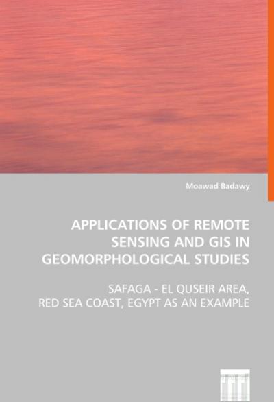
2013, ISBN: 9783639060683
Autor : Badawy, Moawad. The present work represents an endeavour of applyingremote sensing and geographic information systems(GIS) in geomorphological studies. 2004, and Short 2005. Verla… Meer...
| ebay.de dodax-germany 99.5, Zahlungsarten: APPLE_PAY, Paypal, Google Pay, Visa, Mastercard, American Express. Verzendingskosten:Versandkostenfrei, Versand zum Fixpreis, [SHT: Standard Shipping from outside], Zug, [TO: Deutschland, Österreich, Schweiz] (EUR 0.00) Details... |

Applications of Remote Sensing and GIS inGeomorphological Studies : Safaga - El Quseir Area, Red Sea Coast, Egypt as anExample - pocketboek
2008, ISBN: 3639060687
[EAN: 9783639060683], Neubuch, [PU: VDM Verlag Dr. Müller E.K. VDM Verlag Dr. Müller], nach der Bestellung gedruckt Neuware -The present work represents an endeavour of applying remote se… Meer...
| AbeBooks.de AHA-BUCH GmbH, Einbeck, Germany [51283250] [Rating: 5 (von 5)] NEW BOOK. Verzendingskosten: EUR 35.83 Details... |

2008, ISBN: 9783639060683
[ED: Softcover], [PU: VDM Verlag Dr. Müller / VDM Verlag Dr. Müller e.K.], The present work represents an endeavour of applying remote sensing and geographic information systems (GIS) in … Meer...
| booklooker.de buecher.de GmbH & Co. KG Verzendingskosten:Versandkostenfrei, Versand nach Deutschland. (EUR 0.00) Details... |

2008, ISBN: 3639060687
[EAN: 9783639060683], Neubuch, [PU: VDM Verlag Dr. Müller E.K. VDM Verlag Dr. Müller], This item is printed on demand - it takes 3-4 days longer - Neuware -The present work represents an … Meer...
| AbeBooks.de BuchWeltWeit Inh. Ludwig Meier e.K., Bergisch Gladbach, Germany [57449362] [Rating: 5 (von 5)] NEW BOOK. Verzendingskosten:Versandkostenfrei. (EUR 0.00) Details... |

ISBN: 9783639060683
Applications of Remote Sensing and GIS inGeomorphological Studies ab 78.99 € als Taschenbuch: Safaga - El Quseir Area Red Sea Coast Egypt as anExample. Aus dem Bereich: Bücher, Wissenscha… Meer...
| Hugendubel.de Verzendingskosten:Shipping in 1-2 weeks, , Versandkostenfrei nach Hause oder Express-Lieferung in Ihre Buchhandlung., DE. (EUR 0.00) Details... |


2013, ISBN: 9783639060683
Autor : Badawy, Moawad. The present work represents an endeavour of applyingremote sensing and geographic information systems(GIS) in geomorphological studies. 2004, and Short 2005. Verla… Meer...

Moawad Badawy:
Applications of Remote Sensing and GIS inGeomorphological Studies : Safaga - El Quseir Area, Red Sea Coast, Egypt as anExample - pocketboek2008, ISBN: 3639060687
[EAN: 9783639060683], Neubuch, [PU: VDM Verlag Dr. Müller E.K. VDM Verlag Dr. Müller], nach der Bestellung gedruckt Neuware -The present work represents an endeavour of applying remote se… Meer...

2008
ISBN: 9783639060683
[ED: Softcover], [PU: VDM Verlag Dr. Müller / VDM Verlag Dr. Müller e.K.], The present work represents an endeavour of applying remote sensing and geographic information systems (GIS) in … Meer...

2008, ISBN: 3639060687
[EAN: 9783639060683], Neubuch, [PU: VDM Verlag Dr. Müller E.K. VDM Verlag Dr. Müller], This item is printed on demand - it takes 3-4 days longer - Neuware -The present work represents an … Meer...

ISBN: 9783639060683
Applications of Remote Sensing and GIS inGeomorphological Studies ab 78.99 € als Taschenbuch: Safaga - El Quseir Area Red Sea Coast Egypt as anExample. Aus dem Bereich: Bücher, Wissenscha… Meer...
Bibliografische gegevens van het best passende boek
Gedetalleerde informatie over het boek. - Applications of Remote Sensing and GIS inGeomorphological Studies
EAN (ISBN-13): 9783639060683
ISBN (ISBN-10): 3639060687
pocket book
Verschijningsjaar: 2008
Uitgever: VDM Verlag Dr. Müller
308 Bladzijden
Gewicht: 0,474 kg
Taal: eng/Englisch
Boek bevindt zich in het datenbestand sinds 2009-05-19T15:30:45+02:00 (Amsterdam)
Detailpagina laatst gewijzigd op 2023-11-01T10:30:23+01:00 (Amsterdam)
ISBN/EAN: 9783639060683
ISBN - alternatieve schrijfwijzen:
3-639-06068-7, 978-3-639-06068-3
alternatieve schrijfwijzen en verwante zoekwoorden:
Auteur van het boek: moawad, badawy, jensen
Titel van het boek: remote sensing, egypt, safaga, see yourself sensing, gis, area, coast coast
< naar Archief...

