
2012, ISBN: 1566953820
[EAN: 9781566953825], Neubuch, [PU: National Geographic Maps, United States], Language: English. Brand new Book. - Waterproof - Tear-Resistant - Topographic MapAt 13.2 million acres, Wran… Meer...
| AbeBooks.de The Book Depository, London, United Kingdom [54837791] [Rating: 5 (von 5)] NEW BOOK. Verzendingskosten: EUR 0.57 Details... |
2012, ISBN: 1566953820
[EAN: 9781566953825], Neubuch, [PU: National Geographic Maps, United States], Language: English. Brand new Book. - Waterproof - Tear-Resistant - Topographic MapAt 13.2 million acres, Wran… Meer...
| AbeBooks.de The Book Depository, London, United Kingdom [54837791] [Rating: 5 (von 5)] NEW BOOK. Verzendingskosten: EUR 0.59 Details... |

ISBN: 9781566953825
• Waterproof • Tear-Resistant • Topographic MapAt 13.2 million acres, Wrangell-St. Elias could fit Yellowstone, Grand Canyon, Glacier, Olympic, and Yosemite National Parks … Meer...
| BarnesandNoble.com new in stock. Verzendingskosten:zzgl. Versandkosten., exclusief verzendingskosten Details... |

ISBN: 9781566953825
Sheet map, [PU: National Geographic Maps], This two-sided map covers Wrangell - St. Elias National Park in its entirety, along with Tetlin National Wildlife Refuge, portions of Chugach Na… Meer...
| BookDepository.com Verzendingskosten:Versandkostenfrei. (EUR 0.00) Details... |

National Geographic Trails Illustrated Topographic Map Wrangell - St. Elias National Park and Preserve: Alaska - nieuw boek
ISBN: 9781566953825
Natl Geographic Society Maps, 1997. Map. New. map edition. 2 pages. 0.25x9.25x4.25 inches., Natl Geographic Society Maps, 1997, 6
| Biblio.co.uk |

2012, ISBN: 1566953820
[EAN: 9781566953825], Neubuch, [PU: National Geographic Maps, United States], Language: English. Brand new Book. - Waterproof - Tear-Resistant - Topographic MapAt 13.2 million acres, Wran… Meer...

National Geographic Maps:
Wrangell/st.elias National Park: Trails Illustrated National Parks (Sheet map) - nieuw boek2012, ISBN: 1566953820
[EAN: 9781566953825], Neubuch, [PU: National Geographic Maps, United States], Language: English. Brand new Book. - Waterproof - Tear-Resistant - Topographic MapAt 13.2 million acres, Wran… Meer...
ISBN: 9781566953825
• Waterproof • Tear-Resistant • Topographic MapAt 13.2 million acres, Wrangell-St. Elias could fit Yellowstone, Grand Canyon, Glacier, Olympic, and Yosemite National Parks … Meer...

ISBN: 9781566953825
Sheet map, [PU: National Geographic Maps], This two-sided map covers Wrangell - St. Elias National Park in its entirety, along with Tetlin National Wildlife Refuge, portions of Chugach Na… Meer...
Bibliografische gegevens van het best passende boek

| auteur: | |
| Titel: | |
| ISBN: |
• Waterproof • Tear-Resistant • Topographic Map
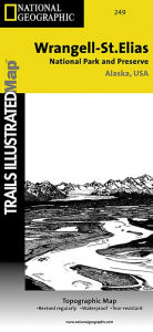
At 13.2 million acres, Wrangell-St. Elias could fit Yellowstone, Grand Canyon, Glacier, Olympic, and Yosemite National Parks within its borders with plenty of room to spare. It stretches from one of the tallest peaks in North America, Mount Stain Elias at 18,008 feet, to to the ocean. More than a quarter of the park is covered with glaciers, including the tidewater Hubbard Glacier, piedmont Malaspina Glacier, and valley Nabesna Glacier.
Arrive in the area using one of only two paved roads or use the mapped landing areas, seaplane bases and anchorage sites and continue your exploration with mapped hiking trails and primitive routes. Two insets show detailed access to the Kennicott Valley and Nabesna. Explore the backcountry using the map's contour lines, elevations, labeled peaks and summits, water features, selected waypoints, areas of wooded cover and color-coded boundaries between different land designations. Other recreation and adventure points of interest include ranger stations, campgrounds, trail shelters, public cabins, restrooms and scenic viewpoints. Some additional map features are background information of the various public lands in the area, wilderness safety tips, bear encounter guidelines and essential contact information.
Every Trails Illustrated map is printed on "Backcountry Tough" waterproof, tear-resistant paper. A full UTM grid is printed on the map to aid with GPS navigation.
Other features found on this map include: Allen Glacier, Bagley Ice Valley, Barnard Glacier, Bering Glacier, Bering Lake, Bremner Glacier, Bremner River, Cape Saint Elias, Cape Suckling, Chisana Glacier, Chistochina River, Chitina Glacier, Chitina River, Chugach Mountains, Chugach National Forest, Columbus Glacier, Copper Lake, Copper River, Dadina River, Gakona River, Granite Range, Gulkana River, Guyot Glacier, Hanagita Peak, Hawkins Glacier, Heney Glacier, Hubbard Glacier, Icy Bay, Jatahmund Lake, Jefferies Glacier, Kaliakh River, Kanak Island, Kayak Island, Kennicott Glacier, Klutina River, Klutlan Glacier, Logan Glacier, Long Glacier, Lucia Glacier, Malaspina Glacier, Martin River, Martin River Glacier, Mentasta Mountains, Miles Glacier, Miles Lake, Mount Augusta, Mount Bear, Mount Blackburn, Mount Bona, Mount Churchill, Mount Drum, Mount Jarvis, Mount Sanford, Mount Wrangell, Nabesna Glacier, Nizina River, Nutzotin Mountains, Ocean Cape, Oily Lake, Point Manby, Point Riou, Regal Glacier, Robinson Mountains, Root Glacier, Russell Fiord, Russell Fjord Wilderness, Russell Glacier, Saint Elias Mountains, Schwan Glacier, Seward Glacier, Sheridan Glacier, Steller Glacier, Tana Glacier, Tana River, Tanada Lake, Tazlina River, Tebay Lakes, Tiekel River, Tongass National Forest, Tonsina Lake, Tonsina River, Tyndall Glacier, Walsh Glacier, Wernicke Glacier, Wingham Island, Woodworth Glacier, Wrangell Mountains, Wrangell-St. Elias National Park, Wrangell-St. Elias National Preserve, Yahtse Glacier, Yakutat Bay.
Map Scale = 1:400,000 & 1:110,000Sheet Size = 13.75" x 9.25"Folded Size = 4.25" x 9.25"Gedetalleerde informatie over het boek. - Wrangell-St. Elias National Park and Preserve National Geographic Maps Author
EAN (ISBN-13): 9781566953825
ISBN (ISBN-10): 1566953820
pocket book
Verschijningsjaar: 2009
Uitgever: National Geographic Maps Core >9
Gewicht: 0,091 kg
Taal: eng/Englisch
Boek bevindt zich in het datenbestand sinds 2009-07-26T13:01:50+02:00 (Amsterdam)
Detailpagina laatst gewijzigd op 2023-11-20T10:07:07+01:00 (Amsterdam)
ISBN/EAN: 9781566953825
ISBN - alternatieve schrijfwijzen:
1-56695-382-0, 978-1-56695-382-5
alternatieve schrijfwijzen en verwante zoekwoorden:
Auteur van het boek: wernicke
Titel van het boek: topographic map, national geographic maps, elia, elias
Gegevens van de uitgever
Titel: Wrangell / St. Elias National Park - National Geographic Trails Illustrated Alaska
Uitgeverij: National Geographic Maps
Taal: Engels
9,99 € (DE)
10,30 € (AT)
Not available (reason unspecified)
CB; GEF; Karten, Globen / Reisen/Karten, Stadtpläne, Atlanten/Nordamerika, Mittelamerika; Landkarten und Atlanten; Nordamerika (USA und Kanada)
Andere boeken die eventueel grote overeenkomsten met dit boek kunnen hebben:
Laatste soortgelijke boek:
0749717012219 National Geographic Trails Illustrated Map Death Valley National Park: Topographic Map (National Geographic Maps)
< naar Archief...